Shute & Merchant


(click on the image for a larger view)
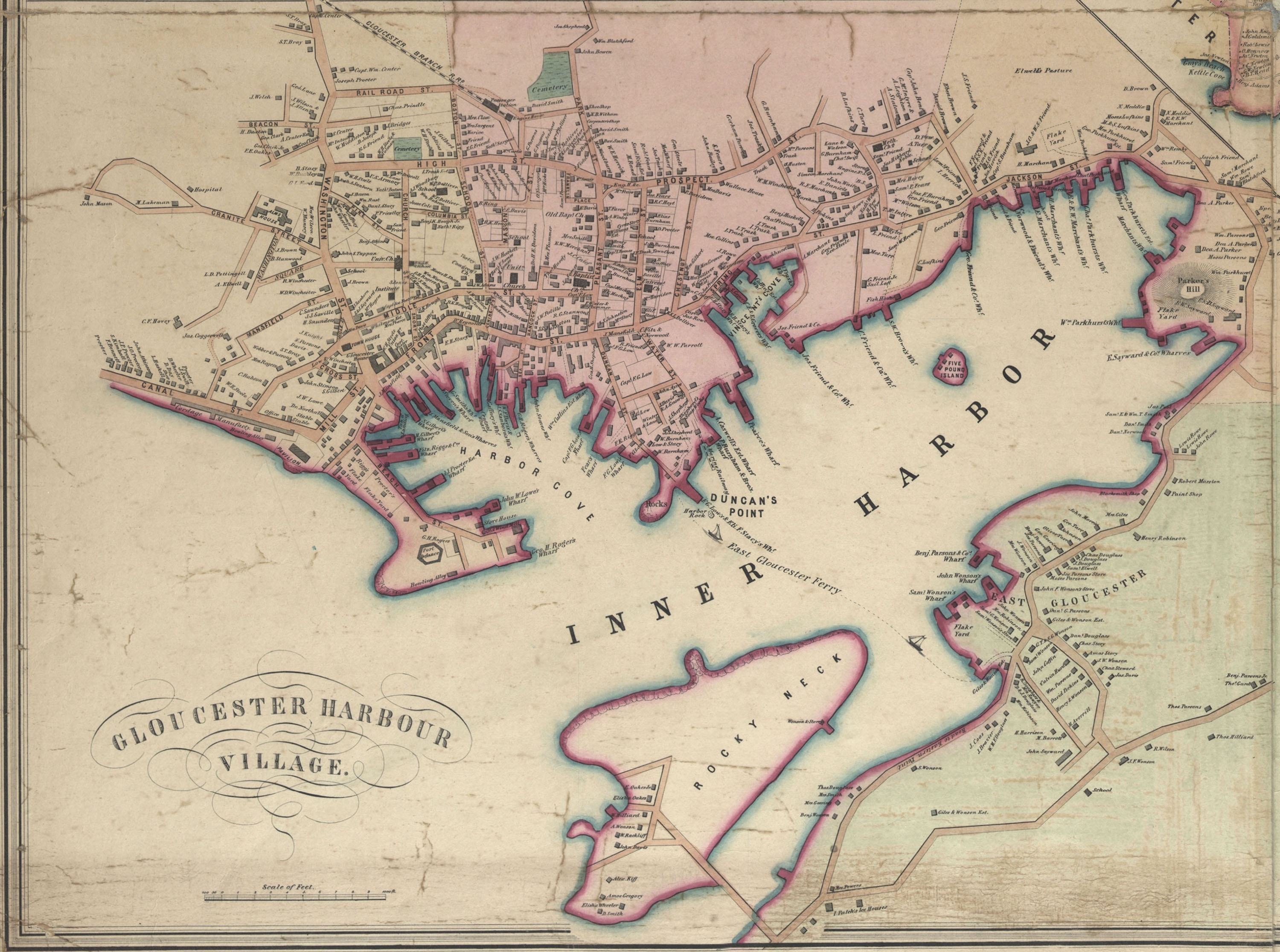
This full map of Gloucester in 1851 shows where all of the businesses ... fish and otherwise, ... were located around the harbor, as well as including the names of many home owners and other important buildings, such as the hospital, schools and two bowling alleys. To the east of where the Merchant wharfs are located at the head of the harbor, along what was then East Main Street, are the homes of several members of this Merchant family.
During the decade or so that surrounding the year this map was drawn, a number of important changes were happening in the fishing industry. 1845 - ice packing/refrigeration was introduced, which changed how the fish could be stored on vessels after it was caught and brought back to port 1845 - "square sterns" began replacing the pinky 1848 - the purse seine was invented, introducing a new method for the fishing industry 1849 - the Burnham Brothers railway was built in response to a need to haul boats out for repair 1850 - the first Gloucester owned clipper was made in Essex 1851 - Gloucester was the largest fishing port in the country 1858 - trawls were introduced, again changing the way large quantities of fish were caught
Some additional facts from this same general time period include the following: according to the 1852 Massachusetts Register, Issue 86, Samuel Merchant, as well as Samuel W. Brown, Simeon Burnham, Epes Davis, Ebenezer Davis, George W. Day, Charles Friend, George Garland, Gustavus Griffin, D. B. Hodgkins, Alfred Mansfield, George Norwood, William Parsons, 2nd, David Parkhurst, Charles Parkhurst, John Pew, Joseph O. Proctor, Fitz E. Riggs, Charles Sawyer, Jr, Epes Sayward, Moses Tarr, Aaron D. Wells, Samuel Wonson, John P. Wonson and John W. Woodbury were the inspectors of the fish for Gloucester -- March 21, 1854, a statute was passed granting Epes Merchant permission to build and maintain a wharf, extending one hundred and fifty feet from a bank wall which incloses the upland at Leighton's Hill, at the head of the harbor, in the town of Gloucester, to be called Merchant's Wharf; and shall have have the right to lay vessels at the end and sides of said wharf, and to receive wharfage and dockage. (would guess this was a new wharf being added to those already noted on the 1851 map)
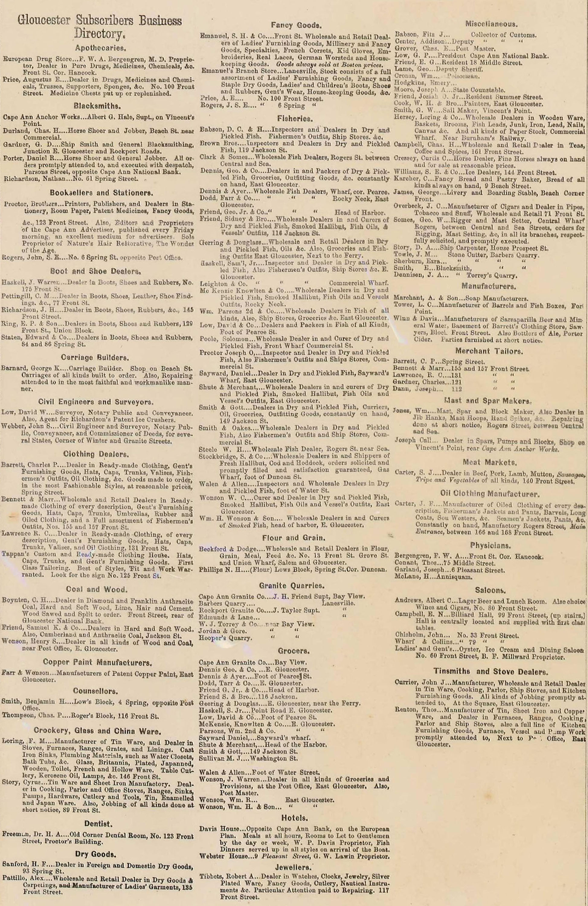
Some maps for cities like Gloucester were actually part of a paid for directory. A map from 1872 inlcudes a long list of business subcribers, including Shute & Merchant. They were one of twenty-five fisheries buisnesses listed on the left side of the map. None of the businesses were marked on the map, however a number of homes locations are indicated on the map.