Shute & Merchant
1884 maps of Gloucester Harbor
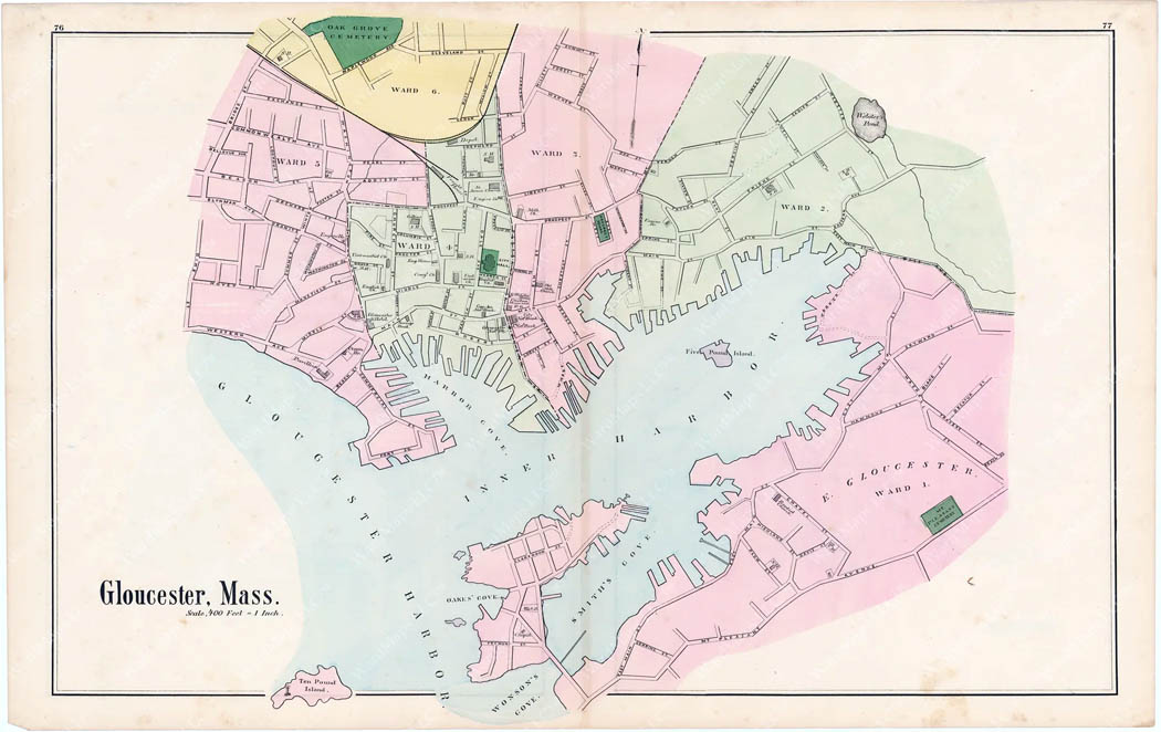
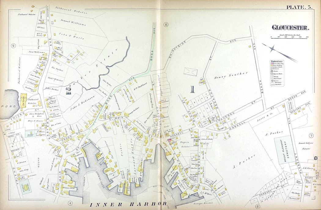
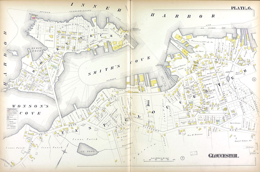
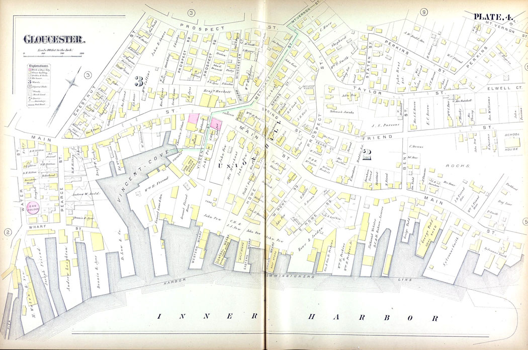
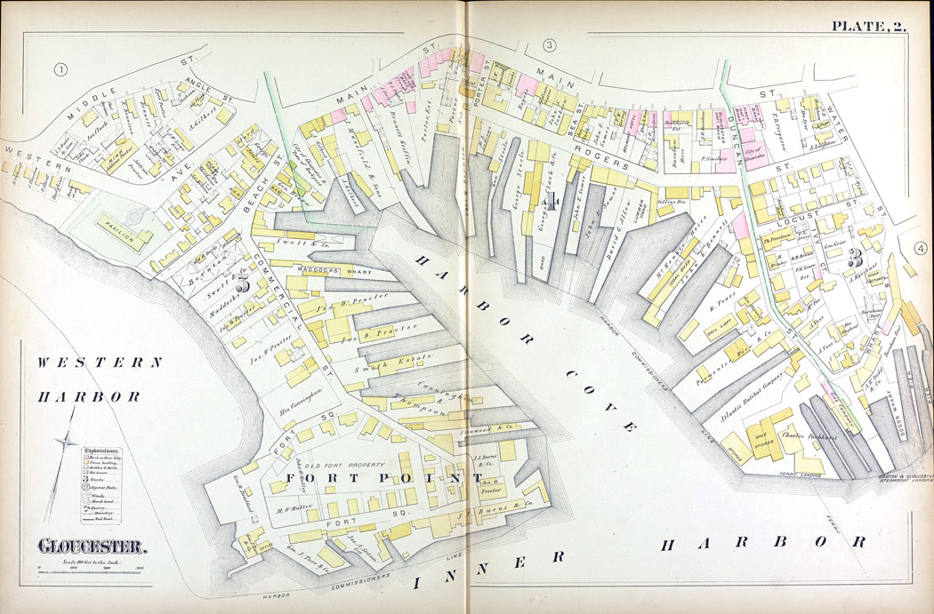
Maps of all kinds were updated every so many years to keep up with changes in the areas depicted. This was also true of the maps showing Gloucester Harbor. For a number of years, including 1884 the maps, some maps identified the businesses located in the areas a section of the map covered, as well as where the buildings associated with the business were situated on the property and the names of property owners. This map provides a complete view of the full Inner Harbor area, but without the detail about the businesses located in the various areas.
According to records, the area of the Inner Harbor that was home to Shute & Merchant was known as the “Head of the Harbor”. This was the inner most section of harbor, and area that came in off of Gloucester Harbor in relation to where the harbor began out near Ten Pound Island and Rocky Neck. In the 1930s in order to improve things for the fishing industry, the area of land that was once home to Shute & Merchant and several other fishing firms was taken over so the State Fishing Pier could be developed.
The Inner harbor begins near Five Pound Island, at the northeast end, in an area of shallows. Those shallows created problems for the vessel owners whose businesses were up that far. In some photos, fishing vessels can be seen lying well over on their sides, which was no doubt related to being in a shallow area when the tide was low.
Smith’s Cove is on the south side of the Inner Harbor, near Rocky Neck -- in East Gloucester. An early view looking at Gloucester from Smith’s Cove was captured in an 1836 lithograph by Fitz Henry Lane.
Moving up along the north side of the Inner Harbor from the Head of the Harbor brings one to Vincent’s Cove. Originall, this small cove was called Vinson’s Cove and had been named for William Vinson, and early settler. The Fitz Henry Lane archive has images and history of Vincent’s Cove. -- That site also has a great article about Vincent’s Cove written by noted model ship builder and historian, Erik A. R. Ronnberg, Jr. In the mid-nineteenth century this cove and surrounding area was an important ship building site. Today Vincent’s Cove no longer exists, as the whole area was later filled and repurposed just as the Head of the Harbor area had been.
The last cove of the Inner Harbor is Harbor Cove, a cove that is bounded by Fort Point and Duncan’s Point. Per historical notes, Harbor Cove was the deepest and most heavily used during the colonial period, and was used for anchorage by for fishing vessels with heavy loads to work on being partially off-loaded, and was at times known as Deep Hole.
