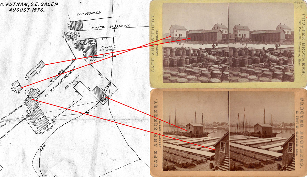
Shute & Merchant


company history
(click on the image to see a larger view)
The 1876 map indicates that the divisions of flats was changed by order of the Supreme Court. While it isn't clear how that changed the look of this part of Gloucester Harbor, the map does provide the sizes of all the buildings located on the Shute & Merchant wharf. In this image lines indicate which of the Shute & Merchant buildings depicted can be seen in stereovviews taken around that same time period. (the stereoviews can also be viewed in the Gloucester Harbor Part 2 section of the Cape Ann Stereoviews)
